
The Chogoria-Sirimon Traverse: Seven Days on Africa's Second Summit
We took a group of six through the full Chogoria ascent and Sirimon descent over seven days. This is what the traverse actually looks like: the views, the camps, and the summit push from Austrian Hut.
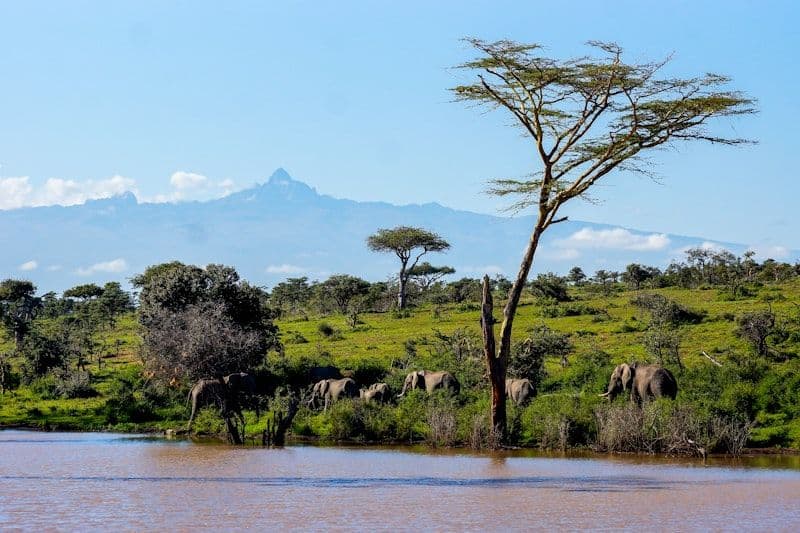
The Chogoria-Sirimon traverse is not the fastest way up Mount Kenya. It is not the cheapest. It is, by some distance, the most complete: two entirely different sides of the mountain in a single trip, connected at the summit.
We ran this trip with a group of six in late March. Here is the route, day by day.
Day 1: Chogoria Gate to Meru Mount Kenya Bandas (3,000 m)
The approach from Chogoria town to the gate is rough road, the kind that makes four-wheel drive a requirement rather than a suggestion. From the gate, the trail enters dense montane forest immediately. Colobus monkeys in the canopy. The sound of the Nithi River somewhere below.
The Meru Mount Kenya Bandas sit at 3,000 m, a cluster of simple bandas run by the Kenya Wildlife Service. Nothing elaborate, but warm and dry after the forest walk. First signs of altitude here for clients who came straight from Nairobi.
Day 2: Bandas to Mintos Camp via Gorges Valley (4,200 m)
This is the day the Chogoria route earns its reputation. The ascent from the bandas through bamboo and giant heather is long and relentless, covering around 1,200 m of gain in 16 km. The reward at the top is Lake Michaelson and the Gorges Valley.
Lake Michaelson sits at the bottom of a glacially carved valley that looks like something borrowed from another continent. The water is perfectly clear and perfectly cold. The peaks above it are close enough to feel imposing. We stopped for forty minutes and no one wanted to leave.
Mintos Camp is at the valley head, just above the lake. Wind-scoured and exposed, but the views from the tent doorway at sunset are worth every layer you can put on.
Day 3: Mintos to Austrian Hut (4,790 m)
The climb from Mintos to Austrian Hut covers 585 m of ascent across 8 km of increasingly dramatic terrain. Hall Tarns, scattered like mirrors across the upper plateau. The Temple and the Diamond Couloir becoming visible for the first time. The air thinning perceptibly.
Austrian Hut is the highest overnight point on any Mount Kenya route, at 4,790 m. It is also the coldest. Two of our six clients had moderate headaches by evening. We managed it with ibuprofen, extra fluids, and an early start the following morning.
Day 4: Summit Day from Austrian Hut (4,985 m)
Starting from Austrian Hut rather than Shipton's Camp gives you a significant advantage on summit day: you are already 590 m closer to the top. The approach to Point Lenana from Austrian Hut takes roughly two to two and a half hours at altitude pace.
We left at 05:30 as the sky began to lighten. The trail from Austrian Hut crosses scree and rock to the summit ridge. The terrain is technical enough to require careful footing, yet straightforward enough that no ropes are needed for Point Lenana. All six summited by 08:00.
Summit temperature was around -4 degrees Celsius with no wind, a good day by Mount Kenya standards. Kilimanjaro was visible as a white dome above the southern horizon.
Days 5 to 6: Descent via Sirimon
Post-summit, we crossed to the Sirimon valley and descended to Shipton's Camp (4,200 m) for the first night. The contrast with the Chogoria approach is immediate: open moorland instead of valley walls, the giant groundsel forests of the upper Sirimon, and wide views across the Laikipia plateau.
Day 6 completed the descent to Old Moses Camp (3,300 m) through the lower heather and forest zones. The altitude loss brings relief: better sleep, better appetite, and the general comfort of breathing easily.
Day 7: Old Moses to Sirimon Gate
The final morning through the lower forest is unhurried. Buffalo in the bamboo zone. The sound of the forest returning as you descend. The gate at 2,650 m, where the vehicle is waiting.
Seven days. Two routes. One mountain. The traverse is the right format for anyone who wants to understand what Mount Kenya actually is, not merely how high it gets.